Wednesday, March 29, 2017

Melliferous flora of Karakalpakstan

Melliferous flora produce substances that can be collected by bees and turned into honey.
 
Photo: Prunus persicaplants

Whilst many plants are melliferous, only certain ones can be harvested by honey bees, those with the right physiognomy (body size, shape, length of proboscis etc.).

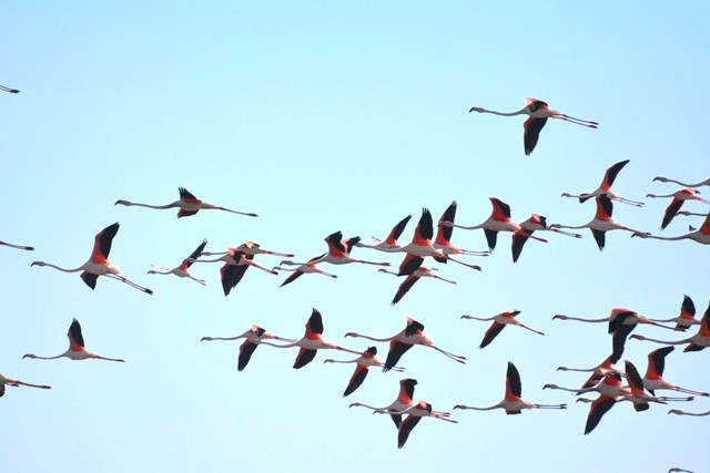
In Karakalpakstan there have been 206 species of wild vascular plants (which belong to 134 genera of 46 families} identified as having commercial value for beekeeping. Among those identified 196 species are also considered to have medicinal properties. Flowering of wild melliferous plants in Karakalpakstan starts from March some of the most common found include Populus nigraL., Roemeria refracta DC, Populus ariana Dode, Ferula foetida (Bunge) Regel, Ammodendron conollyi Bunge, Capparis herbacea Willd, Karelinia caspia (Pall.) Less, Halimodendron halodendron (Pall.) Voss, Fumaria vaillantii Loisel, Elaeagnus turcomanica N. Kozl, Elaeagnus oxycarpa Schlecht. Alhagi  pseudalhagi (Bieb.) Fisch, Glycyrrhiza glabra L, Medicago sativa L.and Althaea armeniaca. After June, the bees start to collect honey from cultivated mellliferous species, such aswith cotton (Gossypium hirsutum L.), clover (Trifolium arvense L.), apricot (A. vulgaris Lam.), jiyda (Elaeagnus angustifolia L.), and peach [Prunus persica (L.) Batsch].   
    
Photo: Uztadbirkoreksport
The bee has been intricately woven into many cultures. Honey and honey based-products have a long tradition as a food source in Central Asia, with the hive and the honey produced nourishing the population for millennia. Once domesticated bees were actively farmed in time their pollination services became recognised as being of equal importance to their honey..


Photo: The main breed of honey bee in Uzbekistan is Apis mellifera carpathica. One of the important biological features of carpathian bees is their peaceful behaviour. This bee is winter hardy, which allows them to successfully come back from a long dormant periods.
 
 Since ancient times honey has been used as a prophylactic food for treating many diseases. There are more than 150 traditional remedy's using honey, either in its pure form or mixed with various food ingredients (e.g., beet, pumpkin) which had strong medicinal and disease-preventive properties, especially those related to the respiratory system. Honey is known to be rich in both enzymatic and nonenzymatic antioxidants, including glucose oxidase, catalase, ascorbic acids, flavonoids, phenolic acids, carotenoid derivatives, organic acids, maillard reaction products, amino acids, and proteins. Through the use of enzymes, bees are able to convert the complex sugar in nectar into more simple sugars. Honey from melliferous flora has good antibacterial and preserving properties (up to 3 months at room temperature) and has long been used for improving human nutrition and boosting immunity. It contains many biologically active substances, as it is collected from many different species of plants. A more saturated honey it has good healing properties and is an important component of many drugs, dietary products, or cosmetics. Pure honey is used to treat coughs and colds. Furthermore, honey is used to prepare an ointment with other plant materials, which can be applied on various wounds as it has good antiseptic properties and prevents the growth of germs and bacteria. In addition, a mixture of honey, butter, and milk was used in the traditional treatment of tuberculosis and other respiratory diseases.
 
Photo: Karakalpakstan has very favourable conditions for beekeeping  
 
In Karakalpakstan the production of honey from cultivated species such as cotton is most promising as it occupies a majority of the planted area. Currently the honey obtained from cotton flowers (Gossypium arboreum and Gossypium herbaceum) constitutes more than 50% of the total regional output. Honey from cotton is creamy with light amber colour and has a mild, pleasant, flowery taste, without excessive acidity. Karakalpakstan as in other parts of Uzbekistan there is an urgent need to preserve the melliferous flora that can sustain bee colonies via the continued conservation and preservation of the natural environment and biodiversity of flora. This will allow for the improvement and expansion of the apiary industry and ensure that it can continue to produce many tons of high-quality, environmentally friendly honey. Source:www.sciencedirect.com/science/article/pii/S2352618116300762 

Thursday, March 23, 2017

Best Bread in the World


Traditional Uzbek bread, called generically non or patyr, is baked in the form of circular flat loaves (lepyoshka in Russian) with a thin decorated depression at the center and a thicker rim all around. Nons are brought to the table with the decorated side up, then torn into irregular chunks which are stacked on the bread plate. Obi non is the staple bread of Uzbek cuisine. Obi nons are mentioned in one of the oldest written works, the Epic of Gilgamesh. Obi nons are baked in clay ovens called tandir. "One having eaten in the morning a slice of obi non with raisins, fried peas or Circassian walnut will not be thinking about food for a long time", a quote from Ibn Sina (Avicenna).

In different areas of Uzbekistan, obi non is baked in different ways. Every region has different varieties of non
  • In Samarkand, small thick obi nons, the shirma nons are the most popular.
  • Bukhara obi non sprinkled with sesame or nigella, making a delicate aroma.
  • Tashkent lochira, plate-formed obi non, baked from short pastry (milk, butter, and sugar). Jirish non is specially prepared bread from flour mixed with wheat.

Monday, March 13, 2017

Sudochie Lakes in Karakalpakstan on the list of Ramsar reservoirs.

Lake Sudochie located in the Muynak district of the Kungrad region of the Autonomous Republic Karakalpakstan, 220 km NW from the town of Nukus.

The Sudochie wetlands consists of a large number of small and four large reservoirs (Akushpa, Karateren, Begdulla-Aydyn and Bolshoe Sudochie) and adjoining areas. In total some 20,000ha. It is one of the most ecologically intact zones of the Amudariya river delta and is a key location for the preservation and maintenance of the biodiversity of the region. The lakes support many breeding waterbird species including rare and disappearing species, all using the Western-Asian migratory route. The Central Asian flyway is a stopover location for waterbirds from the north of Europe and Asia, Western Siberia and Kazakhstan on their migration to wintering areas on the southern Caspian Sea, and onto Africa and the Indian subcontinent. This spring migration begins in the middle of March and ends in the middle of May.

Through the efforts of the society for the protection of birds of Uzbekistan the Sudochye lakes has been nominated and accepted for Ramsar status (see below). To date Ornithologists have counted about two hundred and thirty species of birds on the lakes. With more than 80 species of birds nesting there. These include the pelicans, flamingos,  cormorants, egrets, spoonbills, swans, ducks, gulls and curlews,

Eleven birds on the lake are listed in the Red lists of the International Union for conservation of nature. In 2014 a large colony of nesting red book species of pink flamingos nested in the lake with more than a thousand adult birds. (This year they are back again in large numbers). Also such rare species on the lakes include the Dalmatian Pelican and the white-headed duck. They also noticed (presumed as extinct) the slender-billed curlew. These species alone making this one of the most important Ramsar sites in Central Asia.

The inclusion of these wetlands in the Ramsar List has enhance biosecurity measures in the delta. Ramsar the International Convention On Wetlands of global Importance was accepted on February 2, 1971 in the Iranian city of Ramsar, given the global importance to aquatic and wetland areas. The convention has been ratified by 160 countries around the world to date. About two thousand lakes with total area of 1.836 million square kilometers are now included in the Ramsar List. Uzbekistan joined the Ramsar Convention in 2001. The total area of wetlands in the country is about one million hectares and numbers over 500 lakes. Migrations of many species of waterfowl pass through Uzbekistan, and so it is particularly important to protect these critical habitats, through the preservation of its wetlands.

Source: news.uzreport.uz/news_3_e_141738.html 

Central Asia–Center gas pipeline system


Location
Turkmenistan, Uzbekistan, Kazakhstan, Russia
General direction
south–north-east
From
Dauletabad gas field and Okarem, Turkmenistan
Passes through
Shatlyk gas field, Khiva, Kungrad, Cheleken, Beyneu
To
Alexandrov Gay, Border of Kazakhstan/Russian Federation
Runs alongside
Amu Darya
General information
Type
natural gas
Partners
Gazprom
Türkmengaz
Uzbekneftegas
KazMunayGas
Commissioned
1969
 
Length
2,000 km 
The Central Asia – Center gas pipeline system was the first truly ‘transcontinental gas trunk line system’ in the former Soviet Union connecting the gas fields of Turkmenistan, Kazakhstan and Uzbekistan to industrially advanced regions of central Russia. The  construction and operation of this system  required advanced solutions for long-distance gas transmission in harsh natural and climatic conditions. It was the first system to use large 1,200 to 1,400 millimetre pipes that afterwards were widely accepted as standards for gas trunk line construction in Russia. Today the pipeline system is controlled by Gazprom and consists of a system of natural gas pipelines run from Turkmenistan via Uzbekistan and Kazakhstan to Russia. The eastern branch includes the Central Asia - Centre (CAC) 1, 2, 4 and 5 pipelines, which start from the south-eastern gas fields of Turkmenistan. The western branch consists of the CAC-3 pipeline and a project to build a new parallel Caspian pipeline. The western branch runs from the Caspian Sea coast of Turkmenistan to north. The branches meet in western Kazakhstan. From there the pipelines run to north where they are connected to the Russian natural gas pipeline system.

History - The system was built between 1960 and 1988. Construction began after discovery of Turkmenistan's Dzharkak field in the Amu Darya Basin, and the first section of the pipeline was completed in 1960. CAC-1 and 2 were commissioned in 1969 and CAC-4 was commissioned in 1973. In 1976, two parallel lines were laid between Shatlyk compressor station and Khiva. CAC-5 was commissioned in 1985 and in 1986-88 the Dauletabad–Khiva line was connected. The western branch CAC-3 was constructed in 1972-1975.

Technical features - Almost all Uzbek and Turkmen natural gas is delivered through the CAC pipeline system, mainly through the eastern branch due to location of production sites and poor technical condition of the western branch. CAC-1, 2, 4 and 5 pipelines are supplied from gas fields in the South-East of Turkmenistan, mainly from the Dauletabad gas field. The eastern branch starts from the Dauletabad field and continues through the Shatlyk gas field east of Tejen to Khiva, Uzbekistan. From there the pipeline system transports gas north-west along Amu Darya to the Kungrad compressor station in Uzbekistan. From Kungrad, most of the gas is carried via Kazakhstan to the Alexandrov Gay gas metering station in Russia. At Alexandrov Gay CAC pipelines meet with Soyuz and Orenburg–Novopskov pipelines. From there two lines run northwest to Moscow, and two others proceed across the Volga river to the North Caucasus-Moscow transmission system. The diameter of most pipelines varies from 1,020 to 1,420 millimeters. Current capacity of the system is 44 billion cubic meters (bcm) per year. An agreement is in place to increase capacity to 55 bcm per year by 2010 and through modernization there is potential to increase capacity to 90 bcm per year. The western branch originates at Okarem near the Turkmenistan–Iran border and runs north. It is supplied by gas from fields scattered along the Caspian coast between Okarem and Balkanabat. It continues via Uzen in Kazakhstan to the Beyneu compressor station, where it meets the eastern branch of the CAC. South of Hazar, the western system consists of 710 millimeters diameter pipeline, and between Hazar and Beyneau 1,220 millimeters diameter pipeline.

Wednesday, March 8, 2017

L'Ustyurt

Altopiano di Ustyurt

L'altopiano di Ustyurt (Үстірт, Üstyrt in kazako, Ustyurt platosi in uzbeko, Үстирт, U'stirt in karakalpako, Üstyurtest in turkmeno, плато Устюрт, płato Ustiur in russo) è un altopiano desertico del Kazakistan, dell'Uzbekistan e del Turkmenistan limitato a ovest dal mar Caspio e dal Kara-Bogaz-Gol, a est dal lago d'Aral e dal delta dell'Amu Darya.

Immagine satellitare dell'altopiano di Ustyurt (in evidenza) tra il mar Caspio (a ovest) e il lago d'Aral (a est).

L'Ustyurt è un vasto altopiano di 200.000 km² che si innalza in maniera regolare ma impercettibile dalla falesia sud-orientale del mar Caspio fino alle antiche sponde occidentali del lago d'Aral dove raggiunge una ripida sporgenza, il Chink (che significa «scarpata»), con una modesta altitudine di 250 metri. Non è qui tuttavia che si situa il suo punto culminante di 365 metri (su un'altitudine media di 150 metri), ma nella sua parte sud-occidentale. La superficie dell'altopiano è una lastra di calcare leggermente ondulata e occupata da numerosi bacini endoreici poco profondi, come quello di Barsa-Kelmes a sud-est del lago d'Aral, di origine sia carsica che eolica. Suoli argillosi salati ricoprono il fondo di queste depressioni, in cui cresce qualche pianta e un po' d'erba dopo le rare piogge.

L'altopiano è stato pesantemente eroso durante i periodi più umidi della sua storia geologica, quando si sono formati inghiottitoi, doline e campi solcati. Il clima arido che vi regna da migliaia di anni ha contribuito a fare di questa struttura fisica una hammada dove la vegetazione è quasi assente e dove dominano le vaste distese di pietre spigolose. Le dune sono inesistenti. Nel sottosuolo, la rete carsica è ancora attiva; vi sono degli inghiottitoi di 90 metri di profondità e anche dei laghi sotterranei, alimentati dalle rare precipitazioni, nei quali vive una fauna cavernicola poco studiata.

Idrologia

La rete idrografica è particolarmente carente, essendo rappresentata solamente da alcuni corsi d'acqua temporanei che si perdono rapidamente nel terreno. Gli unici torrenti o fiumi degni di nota scorrono ai piedi dell'altopiano di Ustyurt, come l'Emba, che corre lungo i suoi confini settentrionali prima di gettarsi nel mar Caspio. La ricchezza idrologica dell'altopiano proviene dalle falde acquifere delle quali è satura la maggior parte delle rocce sotterranee e che sono ben conosciute a causa delle numerose ricerche effettuate dai geologi e dai geofisici nell'ambito dell'esplorazione mineraria e petrolifera. Le acque sotterranee che presentano il maggior interesse si trovano nelle arenarie del Cretaceo superiore nel sud-est dell'altopiano; esse sono quasi tutte del tipo clorurato calcico. A causa delle faglie, una parte di queste acque può risalire sotto forma artesiana e formare delle sorgenti salate in superficie. Queste ultime possono alimentare degli stagni salmastri che beneficiano anche dell'apporto delle piogge invernali che lisciviano i terreni più superficiali. Le rare falde superficiali esistenti sono state sistematicamente individuate e utilizzate per l'irrigazione, permettendo di migliorare leggermente la qualità dei pascoli temporanei dell'altopiano, ma attualmente sono tutte prosciugate.

Geologia


Il bordo orientale dell'altopiano di Ustyurt domina l'antico fondale del lago d'Aral.
La geologia dell'altopiano di Ustyurt si fonde spesso con quella della depressione aralo-caspica. La storia dell'altopiano di Ustyurt è antica e risale all'epoca in cui il vasto oceano della Tetide separava il blocco arabo-indo-africano dalle placche antiche, formate da blocchi disuniti, situate a nord di questo antico oceano, celanti al loro interno rocce dell'Archeano (fine del Paleozoico). Uno spesso strato di sedimenti si depositò a partire dalla fine del Paleozoico, durante tutto il Mesozoico, e nel Terziario, fino a quando la Tetide scomparve schiacciata dall'avanzata del blocco arabo-indo-africano. Se la deriva dei continenti verso il nord portò alla formazione delle grandi catene himalayane, lo zoccolo antico non subì alcuna frattura nelle regioni occupate dall'attuale altopiano di Ustyurt. Gli strati sedimentari (calcari di età miocenica) sono rimasti più o meno orizzontali e hanno semplicemente seguito questo zoccolo nei suoi movimenti verticali, che hanno portato alla formazione delle vaste piattaforme corrispondenti a un altopiano sub-orizzontale come l'Ustyurt e alle grandi pianure che formano il grosso dei rilievi dei deserti del Karakum e del Kyzylkum.

Dopo l'Oligocene, un vasto mare, chiamato Sarmato o anche Sarmatico, che si estendeva sul mar Mediterraneo, il mar Nero e il mar Caspio allora riuniti, ricopriva la depressione dell'Asia centrale e depositò sedimenti vari (detti sarmatici). Questi ultimi sono costituiti da argille, sabbie, arenarie, conglomerati e calcari. Essi contengono tracce di evaporiti, testimoni del clima arido che regnava già sulla regione. Dei movimenti verticali, lungo le antiche linee di faglia, influenzarono i confini orientali dell'altopiano di Ustyurt e formarono la scarpata chiamata Chink che ne segna il bordo. Il mare scomparve nel corso del Miocene, poi riapparve durante il Pliocene, ma con una superficie più piccola, anche se era ancora collegato al mar Nero da uno stretto poco profondo. Un braccio di mare, che collegava il mar Caspio all'attuale lago d'Aral, occupava allora la depressione scavata a sud dell'altopiano di Ustyurt da un antico corso d'acqua, il paleo-Oxus, ancora presente nel Quaternario. Quest'ultimo periodo geologico è stato segnato dalle grandi glaciazioni. L'alternanza di periodi freddi (e asciutti tranne che in primavera) e temperati (aridi in pianura e sui bassi altopiani) ebbe poca influenza sull'altopiano di Ustyurt, a eccezione delle avanzate del Caspio che lasciarono dei sedimenti marini intercalati ai depositi fluviali delle epoche di regressione del mare.

Fauna e flora


La saiga, antilope emblematica dell'altopiano di Ustyurt.
L'altopiano di Ustyurt ospita una flora e una fauna ben adattate a un ambiente particolare e difficile. Tra le specie animali più caratteristiche di questo ambiente, troviamo l'urial (Ovis orientalis arkal), un muflone che vive negli ambienti steppici dell'Asia centrale, la gazzella subgutturosa (Gazella subgutturosa) e soprattutto la saiga (Saiga tatarica tatarica), l'unica antilope eurasiatica, caratterizzata dal muso terminante con una piccola proboscide carnosa e dagli occhi sporgenti. Animale simbolo dell'altopiano, quest'ultima è stata inserita nella lista rossa delle specie in pericolo dell'Unione internazionale per la conservazione della natura. Il numero di queste antilopi è drammaticamente diminuito nel corso degli ultimi vent'anni, passando da un milione di esemplari agli inizi degli anni '90 ai circa 40.000 attuali, dei quali 10.000 stanziati sull'altopiano di Ustyurt. Malgrado delle strette misure di conservazione e la creazione di aree protette in Uzbekistan, Kazakistan e Turkmenistan, il numero di saighe è continuato a diminuire a causa di un intenso bracconaggio. La sua carne è infatti molto ricercata, ma sono soprattutto le sue corna, utilizzate dalla medicina tradizionale cinese come un'alternativa al corno di rinoceronte e vendute a un prezzo molto elevato, l'origine dei numerosi abbattimenti. La Cina si è da allora impegnata a ingaggiare una lotta contro la vendita illegale di queste corna, poiché, se non verranno prese apposite misure, la saiga è condannata a scomparire nel giro dei prossimi cinque-sette anni.

Source: https://it.wikipedia.org/wiki/Altopiano_di_Ustyurt
 

Tuesday, March 7, 2017

The Magnificent Usyturt


The Ustyurt is a huge plateau within the Caspian watershed on the territory of Kazakhstan, Uzbekistan and NW Turkmenistan, covering an area of about 200,000 sq. km. It extends from Mangyshlak and Kara Bogaz Gol Bay in the west to the Aral Sea and Amu Darya delta in the east. The plateau rises above the plain to 350 meters, cut off from the surrounding plains by steep inaccessible ledges of the escarpment. To access from Nukus you travel north to Kungrad and then north west above the desert plain there suddenly rise sheer cliffs up to 400 m high called ‘chinks’ a steep pass allows access up onto the plateau. Its seminomadic population raises sheep, goats, and camels. The name is sometimes spelled Ust Urt.    

The Ustyurt Plateau, with its magnificent cliffs, escarpment, scenic canyons and outlying mountains, presents a unique landscape and has an exceptionally rich biological diversity. It has clay-sagebrush and saltwort-sagebrush desert plants, and in its south-eastern part of is clay-and-rock-debris, with alkali spots. The nature of the Ustyurt is fantastic and unique. Many animals that live there are listed in the Red Book of the International Union for Conservation of Nature (IUCN). It is especially beautiful in spring and autumn. Its summer temperature here is more than 50ºC, and often mirages appear in the scorching air. In in winter severe cold winter blows and it can reach 40ºC.  
 
For centuries, the Ustyurt Plateau has been a crossroads of civilizations (Scythians, Mongols and Kazakhs) and it has preserved traces of these many cultures.  Sensational historic discoveries have been made in recent years with more than 60 sites of the Neolithic period being found including the so-called Arana (Arrows), a complex configuration of hundred metres of stone fences which served for mass battue hunting of hoofed herd such as kulans, saiga antelopes and gazelles. 

The famous Silk Way passed through the plateau connecting Khiva with lower reaches of Emba and Volga. Along this trade route there was an ancient city called Shakhr-i-Vazir, Beleuli caravanserai, and Allan fortress. The ancient graveyards with the magnificent mausoleums called ‘mazars’ and other Islamic holy places are scattered across the plateau.

Sunday, March 5, 2017

Desert Saxaul

Photo: Black Saxaul (Haloxylon ammodendron)
Saxaul is found over a huge area (approx. 450,000 sq. km) of semi-arid and arid ecosystems within Central Asia. These so called cold winter deserts range through Uzbekistan, Turkmenistan, Kazakhstan and into Xinjiang, northwest China & Mongolia. Saxual is ranges in size from 2-8 m tall (in rare cases up to 10-12 m tall). It has a brown trunk 4-10 cm (up to 25cm) in diameter. Its wood is heavy and coarse and the bark is spongy and water-soaked. The branches of the young trees are vivid green (new growth) and hanging and turn brown, grey, or white as the tree matures. Branches formed in the current year are green whereas older branches are brown, or grey to white, the leaves of the plant are reduced to very small cusp-like scales, so that it appears nearly leafless. The inflorescences consist of short lateral shoots borne on stems of the previous year and flowers are bisexual or male, very small, als being longer or shorter than the bracteoles. The leaves are reduced to very small, pointed scales so that the plant appears nearly leafless. The flowers are small and yellow.  Flowers appear from March to April. In its fruit, the perianth segments develop, spreading pale brown or white wings diameter of about 8 mm (the seeds about 1.5 mm). Fruits appearing from October to November. Saxaul burns well and in some places it is the only kind of fuel wood that can be utilised for heating and cooking. It is also an important source of water in the arid regions in which it grows. Its thick bark acts as a water storage organ and drinking water can be obtained by pressing quantities of bark. Its wood is also durable and heavy and is used for building shelters.

A large number of birds including the Saxaul sparrow (Passer ammodendri) live in the ecosystem. They are at 14–16 cm long and weight 25–32 grams making them among the larger sparrow species.  A bird of the deserts, it favours areas with shrubs like the saxaul located near rivers and oases. Though it has lost parts of its range due to the expansion of agriculture, to date it is not seriously threatened by human activities.
 
Photo: Saxaul sparrow (Passer ammodendriSource:Haloxylon

Saturday, March 4, 2017

Dark Star Cave - One of the Deepest Cave Systems in Asia

Is Asia's Deepest Cave System Underneath Uzbekistan? GO TO CAVE

Very little is known about the karst and caves in southern Uzbekistan, where some of the deepest caves in Asia have been discovered. In particular, the limestone plateau of the Baisun-tau mountain range has a tremendous potential for exploration.

This region is also important for palaeoclimate studies, as it is situated in the transition zone between the Westerlies and the Indian Summer Monsoon. Up until 15 years ago the  Festival’naya–Ledopadnaya cave system, was the main focus of cavers’ attention. Then, in 2011 the great potential of Dark Star Cave was revealed, after extensive new discoveries were made. Both the length and depth of Dark Star have been increased almost two-fold every year. So far, six entrances and 9,537m of surveyed passages have been discovered to a depth of −858m, and Dark Star has now become the focus of exploration for expeditions to the area.